South Wales doesn’t get nearly enough credit in British road trip conversation. The Lake District and Scottish Highlands take all the headlines, and rightly so, but the Brecon Beacons National Park is hiding some genuinely brilliant tarmac. Sweeping ridge roads, tight valley descents, and long open stretches where you can actually feel your car breathe. If you’ve never pointed a set of wheels towards Powys on a clear weekend morning, you’re missing out on one of the finest Brecon Beacons driving routes available in the UK.
This guide is written for drivers. Not hikers, not cyclists. Drivers. We’ll cover the roads worth seeking out, the ones to treat with respect, fuel stops, base towns, and a few seasonal realities that can catch people out if they’re not prepared.
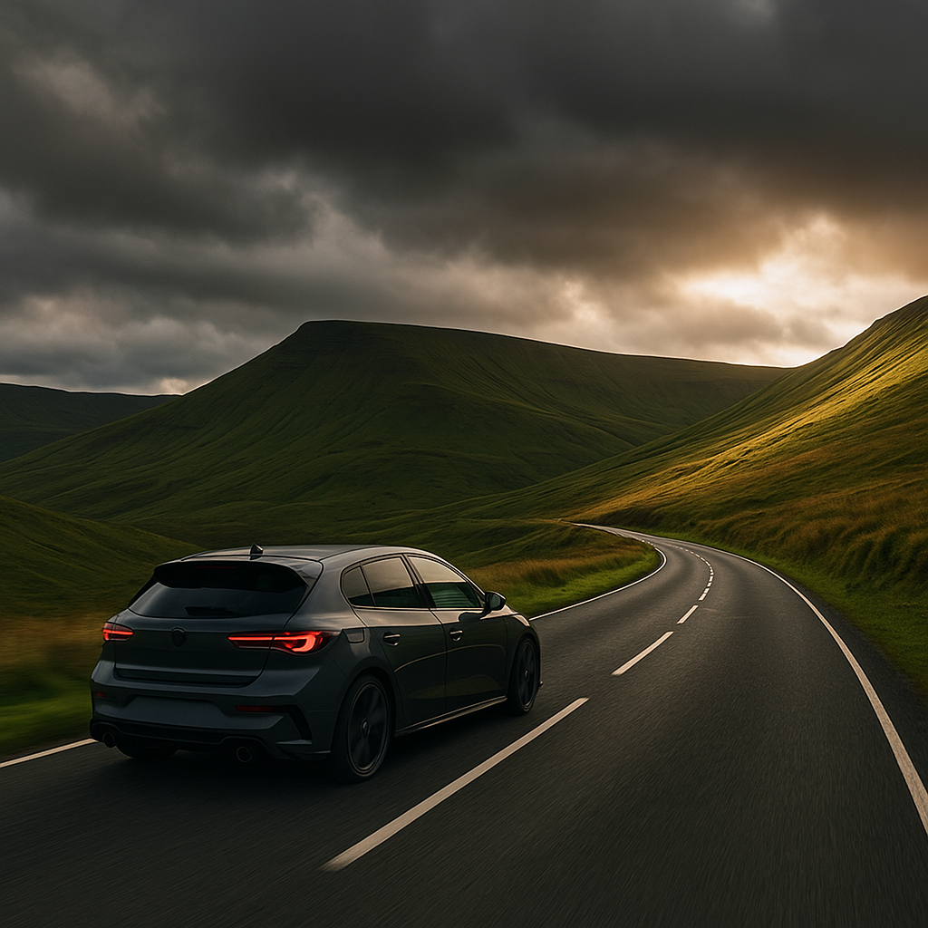
The A470: The Backbone of Any Brecon Beacons Driving Route
The A470 is the spine of the whole trip. Running roughly north-south through the heart of the national park, it passes through Merthyr Tydfil and climbs up towards Brecon itself, taking in the Storey Arms stretch along the way. That particular section, between Merthyr and Brecon, is the one that matters most to driving enthusiasts. You’re climbing to around 440 metres at the highest point, with the Beacons rising sharply on either side and very little between you and the open sky.
The road is well-maintained by Welsh Government standards, but it’s not without its complications. Mist rolls in fast on the high sections, even in summer. Surface grip can vary significantly between the valley floor and the ridge sections. Treat it like a challenging A-road rather than a motorway, which is to say, read the surface, respect the gradient changes, and don’t assume you know what’s on the other side of a blind crest. The bends here reward composed driving rather than aggression.
Storey Arms Stretch: Where It Gets Interesting
Just south of the village of Libanus, the A470 passes the Storey Arms outdoor education centre. This stretch is the one that gets circulated among driving enthusiasts, and with good reason. The road widens slightly but the character stays raw. There are long visibility zones followed by sudden compressions in the road, and the camber shifts in ways that keep you honest. On a dry day in a car with good feedback through the steering, it’s deeply satisfying. On a wet November morning, it requires proper concentration.
One important practical note: this road is heavily used by walkers accessing Pen y Fan, so expect pedestrians crossing, cyclists, and occasional slow-moving vehicles pulling in and out of laybys. Patience is part of the deal. The best windows for cleaner runs are early Saturday mornings from late April through June, before the walking traffic builds.
The B-Roads That Actually Deserve Your Attention
The A470 gets the publicity but the surrounding B-road network is where the real texture is. A few worth building your route around:
- B4520 (Brecon to Builth Wells): Quieter than you’d expect, this road cuts north through the Black Mountains fringe with decent surface quality and long open sections. Good for a relaxed cruise where you can actually take in the scenery without managing heavy traffic.
- B4560 (Llangynidr to Beaufort): This one is properly dramatic. A narrow ridge crossing with steep drops on both sides in places. Not wide enough for aggression but genuinely spectacular. Take it at a measured pace and enjoy it for what it is.
- The Heads of the Valleys Road (A465): Technically outside the national park proper, but the improved western section provides a fast link between the M4 and the park boundary. Useful for approach routing rather than the drive itself.

Fuel Planning in the Beacons
This matters more than most people expect. The national park itself has very limited petrol provision. Brecon town has a station, and Merthyr Tydfil has multiple options on its outskirts, but once you’re in the park interior, you’re largely on your own. If you’re running a performance car or anything with a small tank that you push hard, fill up at Brecon or Merthyr before heading onto the higher routes.
The same logic applies in winter, when some rural filling stations reduce their opening hours. Check ahead if you’re arriving on a Sunday or bank holiday. The DVLA-registered breakdown stats for rural Wales are a reminder of how quickly a planning oversight becomes an expensive recovery job in terrain like this. Don’t let fuel be the thing that ends your day early.
Seasonal Conditions: What Changes and When
Spring and early summer are genuinely excellent for the Brecon Beacons driving route. Roads are clear, visibility is good, and the park looks its best. Late summer brings more traffic, particularly in August, which can make the A470’s Storey Arms section feel more like a queue than a drive.
Autumn is my personal favourite window. October especially. Lighter traffic than August, beautiful light conditions, and the road surfaces are usually in good nick before the first heavy frosts hit. Tyre temperature management matters on cold mornings, so give your tyres proper time to warm up before you push anything.
Winter in the Beacons is real winter. The high sections can and do close with ice and snow. The Traffic Wales service provides live updates on road conditions and closures, and it’s worth bookmarking if you’re planning a winter trip. Ground conditions at altitude here are genuinely dangerous if you’re underestimating them.
Base Towns Worth Using
Where you stay shapes the whole trip. Brecon is the obvious choice: central, plenty of accommodation, good fuel access, and easy morning access to both the A470 and the eastern B-roads. Abergavenny works well if you’re approaching from the M4 and want to explore the Black Mountains section from the south-east. Llandovery in the north is quieter and a better base if you’re combining the Beacons with roads further into mid-Wales.
For those who want a longer drive out, Cardiff to Brecon via the A470 takes roughly an hour in normal conditions and makes a perfectly viable day trip if you leave before 8:00. The return leg as the light drops in autumn is genuinely one of the better drives you’ll do in this part of the world.
Protecting Your Car on These Roads
Mountain and upland roads throw debris at your paintwork. Loose chippings from road maintenance, grit from drainage channels, the occasional farm track runoff crossing the tarmac. If you’re taking a car you care about on a Brecon Beacons driving route, it’s worth thinking about paint protection before you go. Products like ProFilm PPF (paint protection film) are precisely the kind of thing that makes sense for a car that sees real roads rather than just a Sunday car park cruise.
A Suggested Two-Day Route Structure
Day one: arrive in Brecon, fuel up, and head south on the A470 through the Storey Arms stretch to Merthyr, then back north via the B4560 Llangynidr ridge road. That loop alone gives you about 45 miles of genuinely engaging tarmac. Day two: head east on the A40 towards Abergavenny, cut through the Black Mountains on the B4423 or B4246, and return via the Vale of Ewyas if conditions allow. The narrow lane up through Llanthony is not for wide cars, but if your vehicle fits, it’s an extraordinary piece of Welsh road with almost no traffic.
The Brecon Beacons driving route isn’t just a journey through scenery. It’s a proper test of how well you know your car, how well you read a road, and how much you actually enjoy the act of driving rather than just the destination. South Wales does all of that rather well.
Frequently Asked Questions
What is the best road to drive in the Brecon Beacons?
The A470 between Merthyr Tydfil and Brecon is considered the standout route, particularly the Storey Arms stretch at altitude. For more technical driving, the B4560 between Llangynidr and Beaufort offers a dramatic ridge crossing with excellent character.
When is the best time of year to drive the Brecon Beacons?
Late spring (May to June) and October are the best windows for driving enthusiasts. Traffic is lighter than August, road surfaces are generally in good condition, and visibility tends to be better. Winter visits require careful preparation due to ice and possible road closures at altitude.
Are there petrol stations in the Brecon Beacons National Park?
Fuel options within the park are limited. Brecon town and Merthyr Tydfil on the southern boundary both have petrol stations, and you should fill up at either before heading onto the higher routes. Rural stations in Wales often have reduced hours on Sundays and bank holidays.
How do I check for road closures on Brecon Beacons roads in winter?
Traffic Wales (traffic.wales) provides live road condition updates and closure information for Welsh roads, including the A470. It is worth checking the morning of any winter trip before setting off, as the high sections can close with ice or snow.
What base town should I use for a Brecon Beacons driving trip?
Brecon is the best all-round base, offering central location, good fuel access, and easy morning access to both the A470 and eastern B-roads. Abergavenny is a strong alternative if you are approaching from the south-east and want to focus on the Black Mountains roads.
Leave a Reply